When we think about great streets, it’s not just about space for cars—it’s about how people move, gather, and connect with their communities. Streets are public spaces, and when thoughtfully designed they are safe, comfortable, and inclusive for everyone—whether you walk, bike, roll, are using public transit, or driving.
Imagine a week where we all choose transportation alternatives to driving our own cars solo: walking, biking, using public transit, or ride sharing. Sure, there may be some downsides - cars are oftentimes convenient - but think about the upsides. This shift in our behavior can significantly reduce traffic congestion, lower fossil fuel exhaust emissions, and improve our air quality. A Week Without Driving can also foster empathy and understanding for those can't take advantage of the benefits of a personal car.
We are excited to announce the launch of the LA Metro Owl Service Map – a new transit map showcasing bus services that operate between 12-4 AM. This product informs commuters who depend on public transit during late night hours.
The Owl Map demonstrates Metro's commitment to continuously improve access to reliable, 24/7 public transit options. DCR collaborated with Metro's Service Planning division to conceive this newest member of the Metro transit map product suite.
Below is a glimpse into how this map was brought to life.
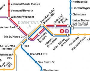
DCR has collaborated with LA Metro over the past few months to re-design and update the majority of its customer-facing maps, triggered by Regional Connector, a significant new enhancement to the Metro Rail network. The Regional Connector is a nearly 2 mile long underground rail project that adds three new stations to the Metro network and increases the rail connections between Union Station and 7th Street/Metro Center, the two Downtown LA transit hubs. This creates better opportunities for travelers, reducing transfers in Downtown LA and shortening journey times through the middle of LA.
Last year, DCR worked with Rideshare to develop an online bike map web app. This tool is great for planning a local or regional bike trip, and learning more about the opportunities of biking in SLO County.
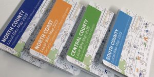
This spring, we continued our collaboration by designing and producing a set of durable, portable printed bike maps for SLO County.
DCR was proud to sponsor, mentor and judge the 5th Annual Cal Poly San Luis Obispo Camp PolyHacks hackathon – which took place January 21-22, 2023 at the CIE Hothouse in Downtown SLO. Camp PolyHacks is a student-run, multidisciplinary hackathon dedicated to social entrepreneurship and human-centered design.
Teams are allotted 24 hours to design a creative solution to a theme issue. This year, one of the themes was about local transportation and infrastructure!
In 2020 there were 6,516 pedestrians killed due to motor traffic in the United States. That equates to 18 pedestrians every day or 125 pedestrians every week. Why does this happen? Walking isn't an inherently dangerous activity – but walking in an environment that's built primarily for cars is. Recognizing this serious problem is not difficult, but reversing trends and creating safer walking and biking environments requires re-designing our streets so everyone feels safe, regardless of their mode of transportation.
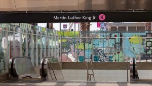
DCR has been busy working on a range of maps for the opening of the new LA Metro K Line. This involved creating new station maps as well as updating many existing maps showing the new station areas and transit system connections. Take a virtual ride along the entire line, which opened on Friday, October 7 2022. The need for the K Line was first recognized in 1967 – but there was a lack of funding at the time. When the Measure R sales tax was passed by LA County voters, funding was finally secured. Since then, hundreds of people have spent countless hours to make the K Line a reality.
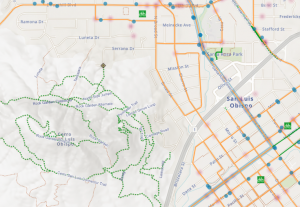
DCR is happy to announce the availability of a new web application for the County of San Luis Obispo. In addition to bikeway infrastructure, the map shows MTB and hiking trails along with trailheads, bus stops, bike shops and more. The map was developed on behalf of the SLO Rideshare program. We hope to follow on with a set of printed maps as well.
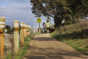
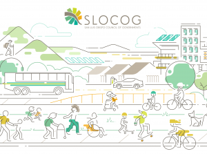
We recently helped the San Luis Obispo Council of Governments launch their first ever Active Transportation Plan. Together with project partners Pedal Love, we used storytelling from community members and visual information design to enhance the overall communication of the report.