Step onto a busy street at rush hour and you will see the climate challenge in motion: long lines of cars, most carrying just one person, inching forward. Now imagine that same street with fewer cars and, instead, more buses moving steadily along, each carrying dozens of people.
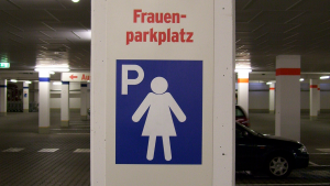
In parking garages across Germany, you might spot something unexpected: parking spaces marked with a silhouette of a woman and the word Frauenparkplatz—women’s parking space. They're typically located near building entrances, under bright lights, and within view of surveillance cameras. For women drivers, these spots are an obvious safety measure.
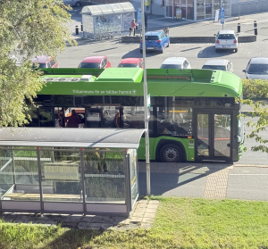
Let’s make 2026 a breakout year for bus transit! With the right mix of service upgrades, stop-area improvements, and smart pricing and outreach, agencies can turn bus transit from a second-rate way to get around into a first-choice for many people who rarely or never ride today.
It’s National Teen Driver Safety Week, and time to have an honest conversation: 16 is too young to be behind the wheel. The data backs this up — motor vehicle crashes remain a leading cause of death for teens aged 15 to 18 in the U.S., with 2,611 lives lost in 2023 alone in crashes involving teen drivers (NHTSA). Instead of being a footnote, this should be a call to action.
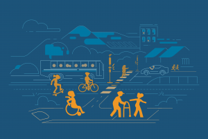
October is National Pedestrian Safety Month, a time to highlight a simple fact: walking should never come with risk. Whether it’s walking to school, to work, to transit, in a parking lot or just around the block, we are all pedestrians at some point.
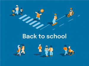
As the school year begins, the daily rhythms of our streets shift and become more active. What felt like a quiet intersection in July may now be packed with bikes, buses, and families on the move. It’s not chaos — it’s a system kicking back into gear. And how well it functions says a lot about how we’ve designed it, and how we prioritize safe and sustainable travel.
July being Parks and Recreation Month, and World Population Day set for today, July 11, might feel like separate calendar entries, but they both highlight a common truth: healthy communities need transit systems that connect residents and visitors to green space, community space, and each other.
California is reaching an exciting milestone with the release of its updated State Rail Plan, a forward-thinking blueprint designed to improve the State rail network for cleaner, faster, and more accessible travel. Implementing this plan will not only strengthen the backbone of California’s rail system but also reduce greenhouse gas (GHG) emissions, support economic growth, and offer better transit connections for commuters.
As Los Angeles prepares to host the 2028 Summer Olympics, City leaders are talking about a car-free (or transit-first) experience, drawing lessons from Paris, who just held the 2024 Olympics. Planned and executed carefully, these can be transformational events where a focus on inclusive transportation and environmental goals take center stage.
Imagine a week where we all choose transportation alternatives to driving our own cars solo: walking, biking, using public transit, or ride sharing. Sure, there may be some downsides - cars are oftentimes convenient - but think about the upsides. This shift in our behavior can significantly reduce traffic congestion, lower fossil fuel exhaust emissions, and improve our air quality. A Week Without Driving can also foster empathy and understanding for those can't take advantage of the benefits of a personal car.