
Transit is expanding in LA
And we’re proud to be helping!
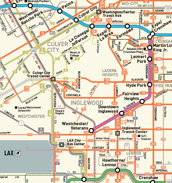
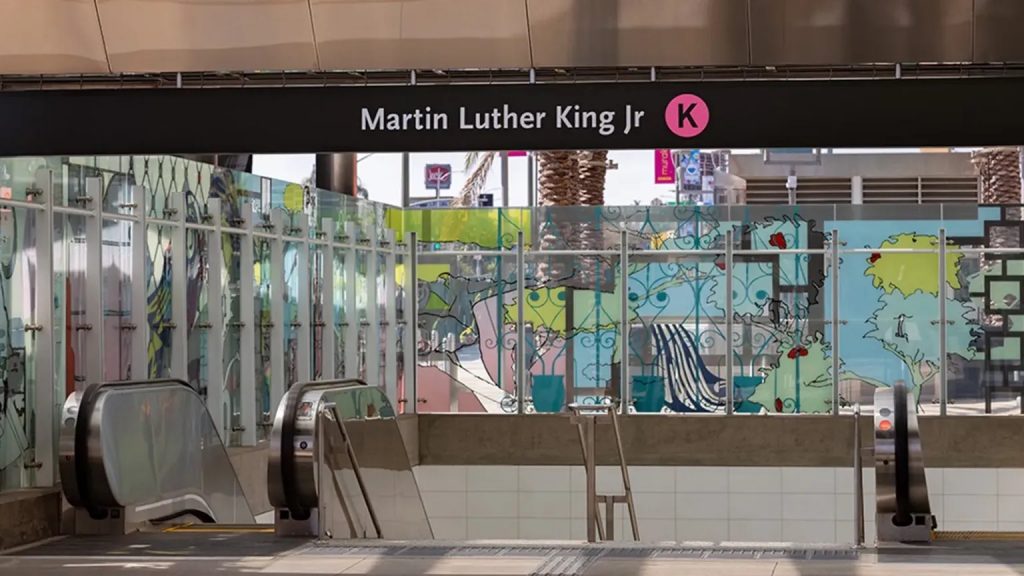
DCR has been busy working on a range of maps for the opening of the new LA Metro K Line. This involved creating new station maps as well as updating many existing maps showing the new station areas and transit system connections. Take a virtual ride along the entire line, which opened on Friday, October 7.
The need for the K Line was first recognized in 1967 – but there was a lack of funding at the time. When the Measure R sales tax was passed by LA County voters, funding was finally secured. Since then, hundreds of people have spent countless hours to make the K Line a reality.
As LA Metro writes on its website, “The K Line will connect to the Metro E Line (Expo), which travels between downtown LA and Santa Monica. By 2024, the K Line will also connect to the new LAX/Metro Transit Center Station, the new Aviation/Century Station and the Metro C Line (Green).” The K Line runs both at street level and underground,
DCR’s role
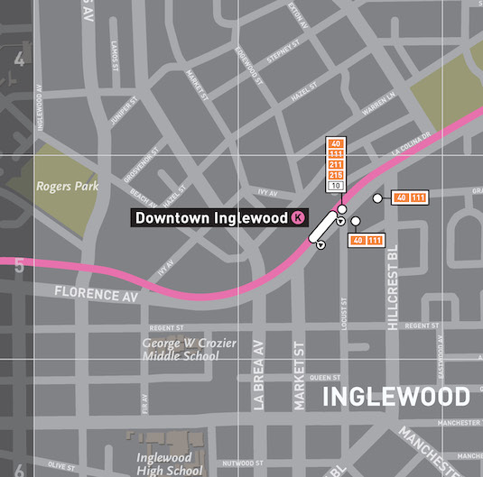
The introduction of a new metro line impacts not just one map – but many! We have been hard at work adding the K Line to a wide range of LA Metro customer information products, both for print and online use. The K Line Connection maps are of particular importance. Appearing as large format posters at the new stations, they assist passengers with their onward transit connections as well as showing nearby points of interest.
Our efforts are ongoing
Now that the K Line is open to the public, there is more new LA transit on the horizon. The Regional Connector, scheduled to open in early 2023, will have an even greater impact on improving customer journey options in LA. Of course, a lot of new and revised customer information will be required. We look forward to continuing our work with LA Metro.
You can learn more about the K Line opening at kline.metro.net.

Want to work with us? Feeling inspired?
Contact us at info@dcrdesign.net or checkout our social medias: LinkedIn, X and Instagram
For more information visit:
Vision Zero, Safe systems approach. NHTSA and FHWA