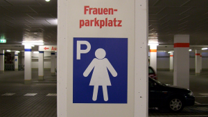
In parking garages across Germany, you might spot something unexpected: parking spaces marked with a silhouette of a woman and the word Frauenparkplatz—women’s parking space. They're typically located near building entrances, under bright lights, and within view of surveillance cameras. For women drivers, these spots are an obvious safety measure.
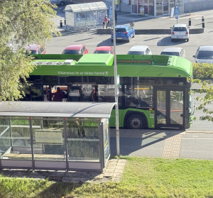
Let’s make 2026 a breakout year for bus transit! With the right mix of service upgrades, stop-area improvements, and smart pricing and outreach, agencies can turn bus transit from a second-rate way to get around into a first-choice for many people who rarely or never ride today.
Last year, our piece on urban heat and canopy struck a chord. It resonated not just because people care about trees and greenery, but because they care about comfort, dignity, and good urban design. People need shade while waiting for a bus, shade helping transit stops serve people better.
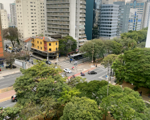
When we think about great streets, it’s not just about space for cars—it’s about how people move, gather, and connect with their communities. Streets are public spaces, and when thoughtfully designed they are safe, comfortable, and inclusive for everyone—whether you walk, bike, roll, are using public transit, or driving.
May is Bike Month! Numerous events, for cycling enthusiasts everywhere, mark the arrival of National Bike Month. Biking isn’t just a mode of transportation; for many it’s a lifestyle that embodies a commitment to wellness and environmental stewardship. As spring blooms around us, there’s no better time for people of all ages to embrace the joy of cycling, enjoy a ride to work or school, or simply to explore the world around them. This positive energy should help promote safer infrastructure for everyone.
We are excited to announce the launch of the LA Metro Owl Service Map – a new transit map showcasing bus services that operate between 12-4 AM. This product informs commuters who depend on public transit during late night hours.
The Owl Map demonstrates Metro's commitment to continuously improve access to reliable, 24/7 public transit options. DCR collaborated with Metro's Service Planning division to conceive this newest member of the Metro transit map product suite.
Below is a glimpse into how this map was brought to life.
In the United States, more than half of all trips taken are less than five miles long (source FHWA, 2022). It makes sense that many short trips could easily be done via active transportation (like walking and biking) or public transportation. So why are cars such a large part of our culture? The short answer is that the car industry and car-related road infrastructure has been prioritized historically, while infrastructure supporting active and public transportation has not been – often making the latter inconvenient, inconsistently available and unsafe.
DCR was proud to sponsor, mentor and judge the 5th Annual Cal Poly San Luis Obispo Camp PolyHacks hackathon – which took place January 21-22, 2023 at the CIE Hothouse in Downtown SLO. Camp PolyHacks is a student-run, multidisciplinary hackathon dedicated to social entrepreneurship and human-centered design.
Teams are allotted 24 hours to design a creative solution to a theme issue. This year, one of the themes was about local transportation and infrastructure!
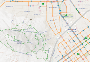
DCR is happy to announce the availability of a new web application for the County of San Luis Obispo. In addition to bikeway infrastructure, the map shows MTB and hiking trails along with trailheads, bus stops, bike shops and more. The map was developed on behalf of the SLO Rideshare program. We hope to follow on with a set of printed maps as well.
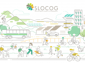
We recently helped the San Luis Obispo Council of Governments launch their first ever Active Transportation Plan. Together with project partners Pedal Love, we used storytelling from community members and visual information design to enhance the overall communication of the report.