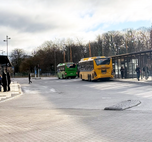
In the United States, buses are the overlooked workhorses of daily transportation. While trains and planes often get the spotlight, buses actually move far more people each year when measured by total boardings.
California is reaching an exciting milestone with the release of its updated State Rail Plan, a forward-thinking blueprint designed to improve the State rail network for cleaner, faster, and more accessible travel. Implementing this plan will not only strengthen the backbone of California’s rail system but also reduce greenhouse gas (GHG) emissions, support economic growth, and offer better transit connections for commuters.
We are excited to announce the launch of the LA Metro Owl Service Map – a new transit map showcasing bus services that operate between 12-4 AM. This product informs commuters who depend on public transit during late night hours.
The Owl Map demonstrates Metro's commitment to continuously improve access to reliable, 24/7 public transit options. DCR collaborated with Metro's Service Planning division to conceive this newest member of the Metro transit map product suite.
Below is a glimpse into how this map was brought to life.
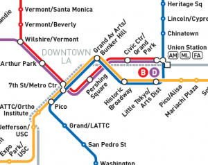
DCR has collaborated with LA Metro over the past few months to re-design and update the majority of its customer-facing maps, triggered by Regional Connector, a significant new enhancement to the Metro Rail network. The Regional Connector is a nearly 2 mile long underground rail project that adds three new stations to the Metro network and increases the rail connections between Union Station and 7th Street/Metro Center, the two Downtown LA transit hubs. This creates better opportunities for travelers, reducing transfers in Downtown LA and shortening journey times through the middle of LA.
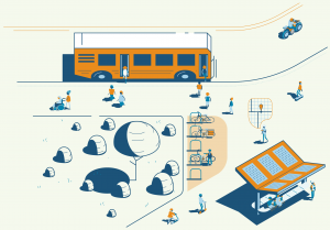
In the United States, more than half of all trips taken are less than five miles long (source FHWA, 2022). It makes sense that many short trips could easily be done via active transportation (like walking and biking) or public transportation. So why are cars such a large part of our culture? The short answer is that the car industry and car-related road infrastructure has been prioritized historically, while infrastructure supporting active and public transportation has not been – often making the latter inconvenient, inconsistently available and unsafe.
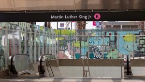
DCR has been busy working on a range of maps for the opening of the new LA Metro K Line. This involved creating new station maps as well as updating many existing maps showing the new station areas and transit system connections. Take a virtual ride along the entire line, which opened on Friday, October 7 2022. The need for the K Line was first recognized in 1967 – but there was a lack of funding at the time. When the Measure R sales tax was passed by LA County voters, funding was finally secured. Since then, hundreds of people have spent countless hours to make the K Line a reality.
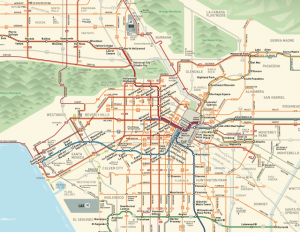
Every year ESRI collects a wide range of mapping products made by users all over the world and displays them in an online map gallery together with a printed book. This year, our redesign of LA Metro's Bus & Rail System Overview Map is showcased in the ESRI Map Gallery and printed book (Volume 37).
To see our map alongside many other interesting mapping projects in the gallery, use this link!