
SacRT System Map Redesign
DCR Design led a complete redesign of the Sacramento Regional Transit’s (SacRT) bus and rail system map — modernizing the visual language, improving geographic accuracy, and developing a flexible product that can be edited and adapted into the future.
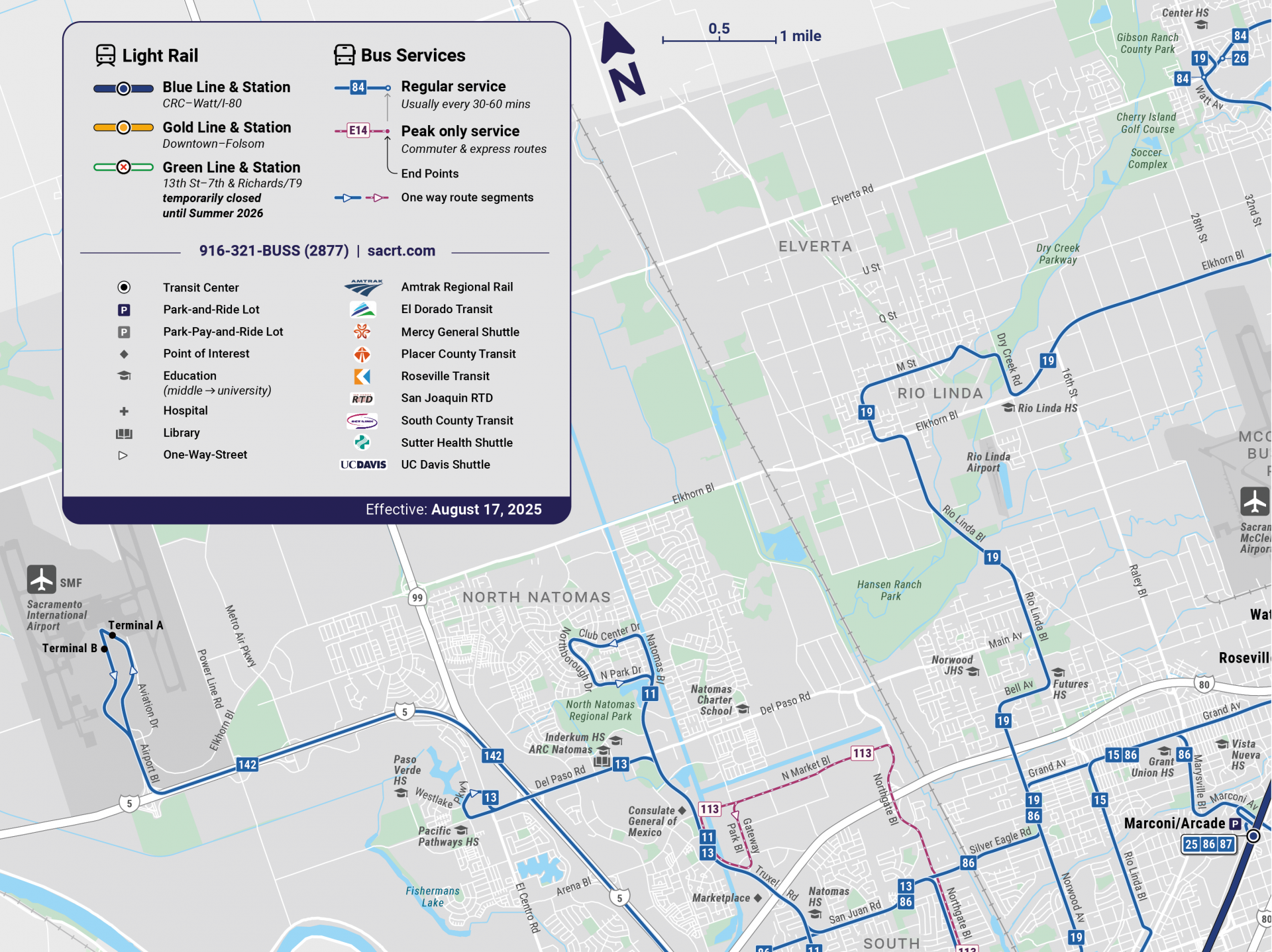
SacRT’s previous schematic map had strong bones, and our redesign was inspired by its clarity and character. The new map is true to scale, highly legible, and built to adapt across print, digital, and interactive formats. The result gives SacRT new opportunities to communicate their network more clearly to riders.
Highlights of the new SacRT System Map include:
- Rebuilt the map from the ground up, incorporating SacRT’s brand standards, color palette, typography, and graphical language.
- A new design strategy that scales across all applications, from small screens to station posters.
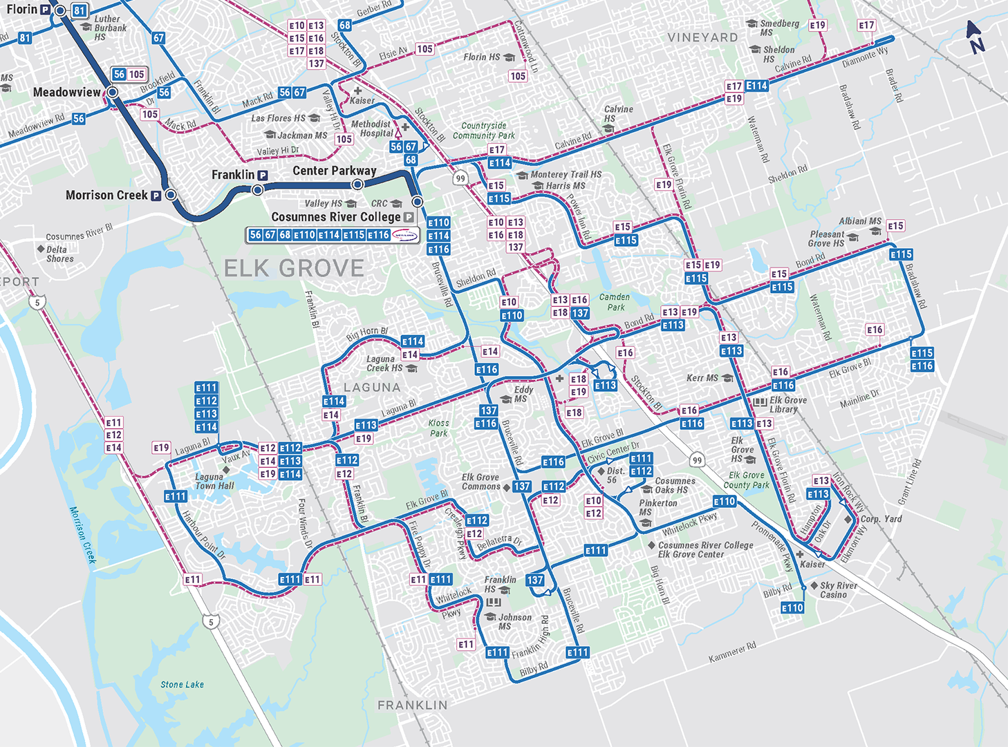
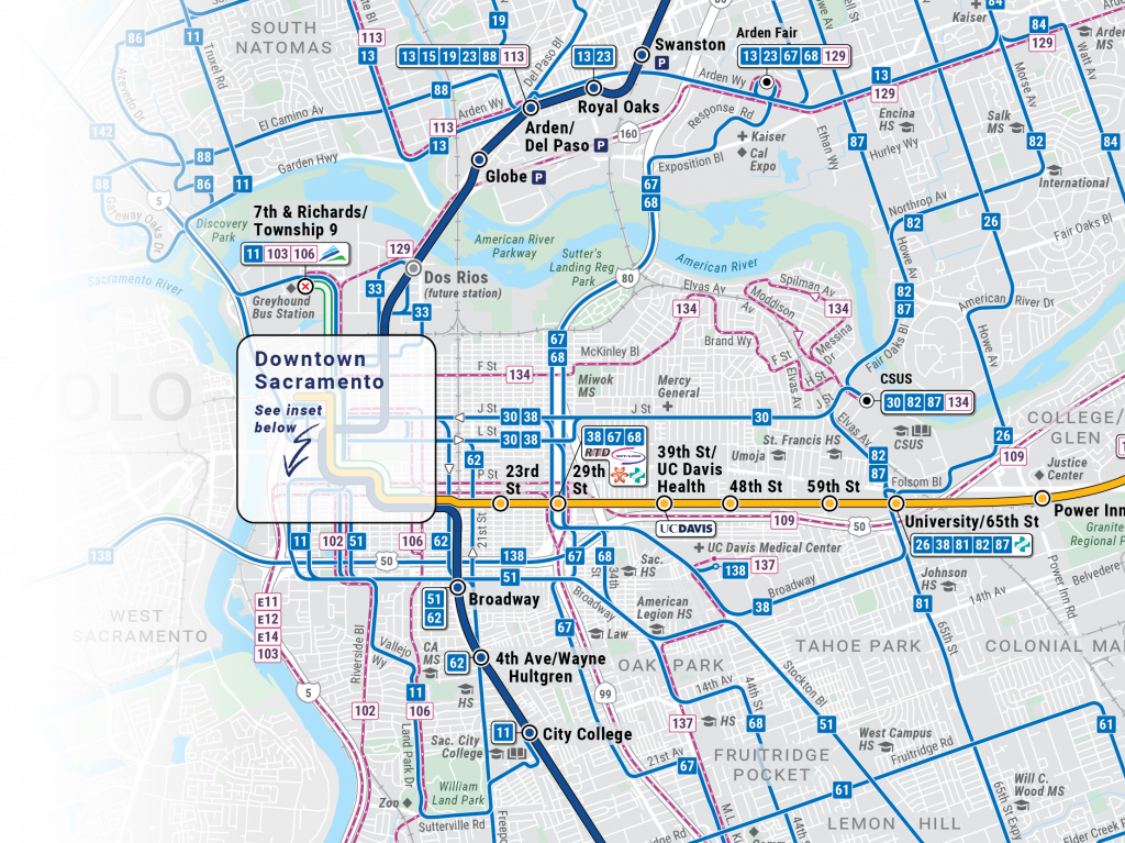
- A new geographically accurate layout.
- Added neighborhood streets, key landmarks, and contextual geography, modeled on modern transit map conventions while tailored to SacRT’s needs
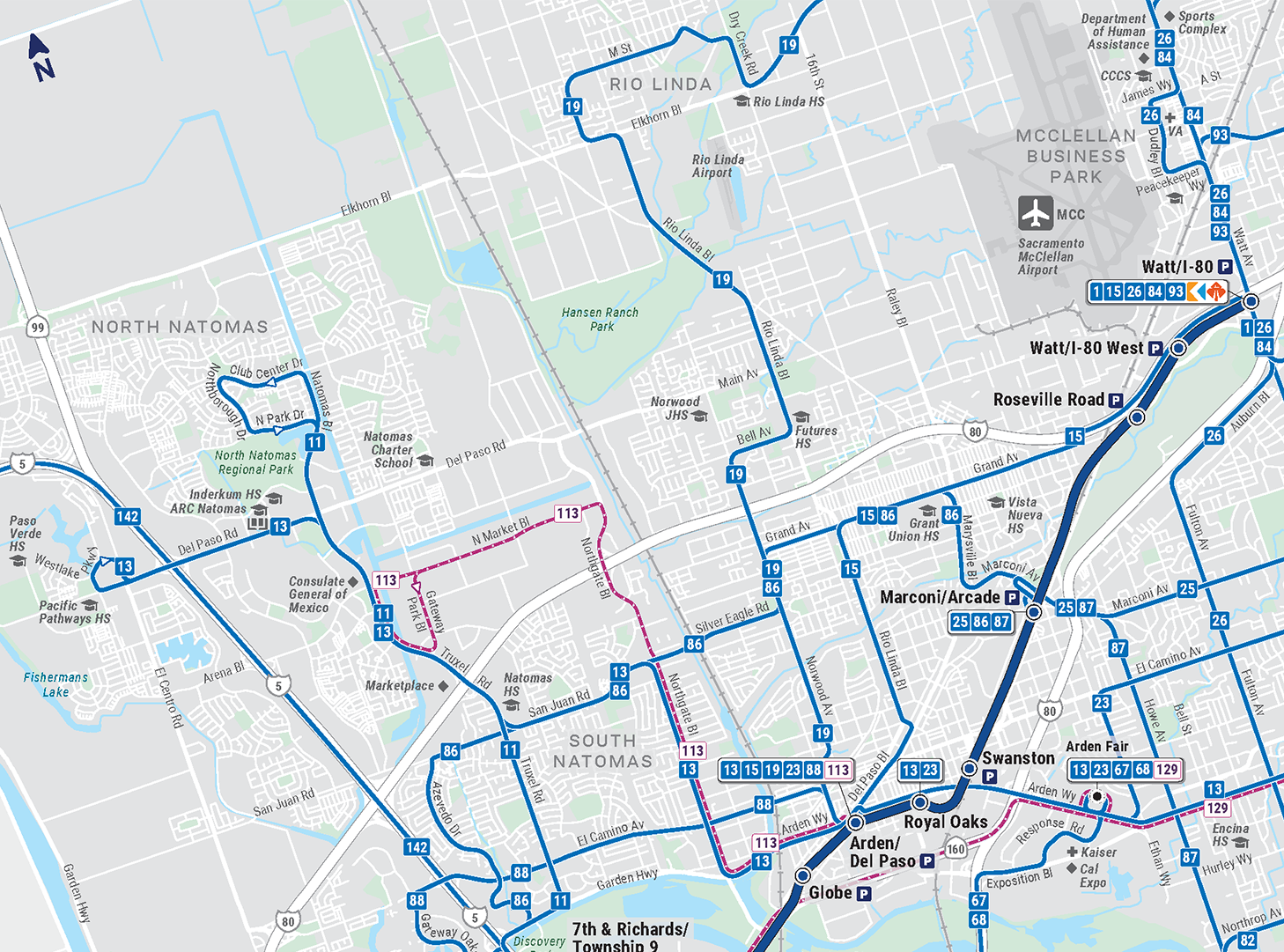
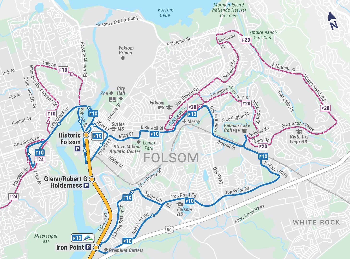
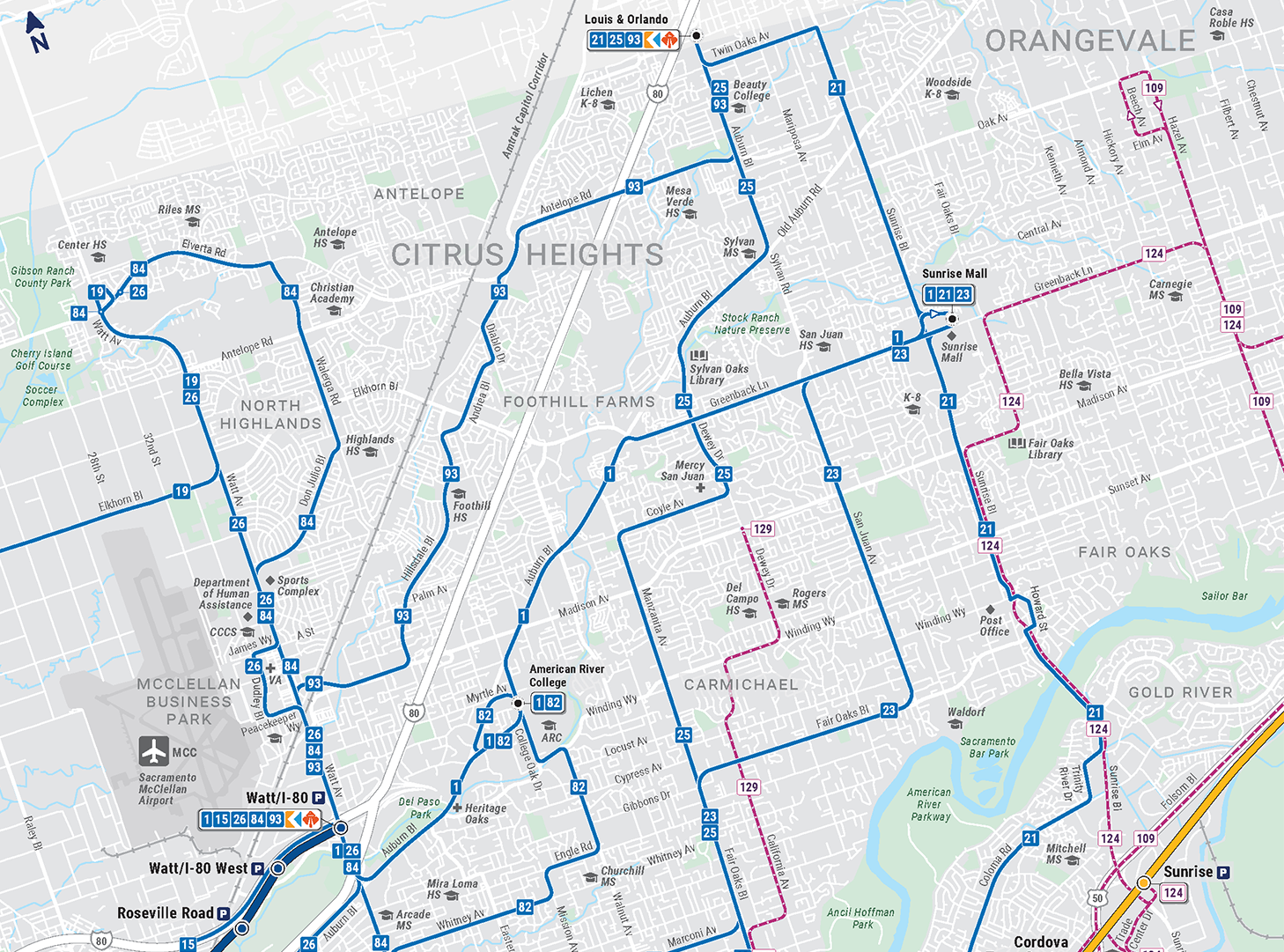
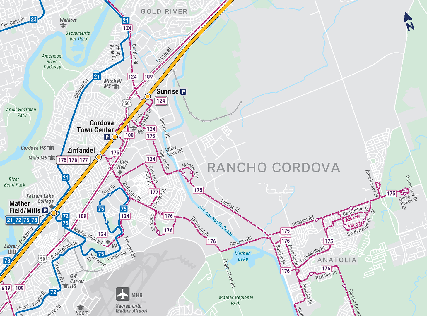
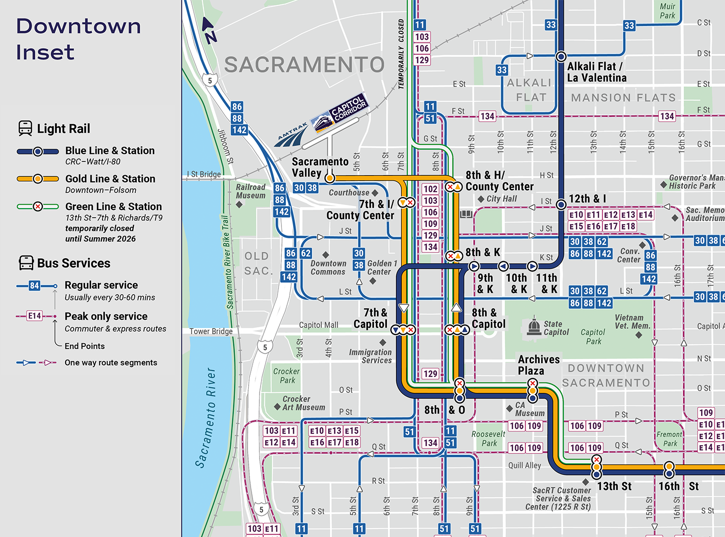
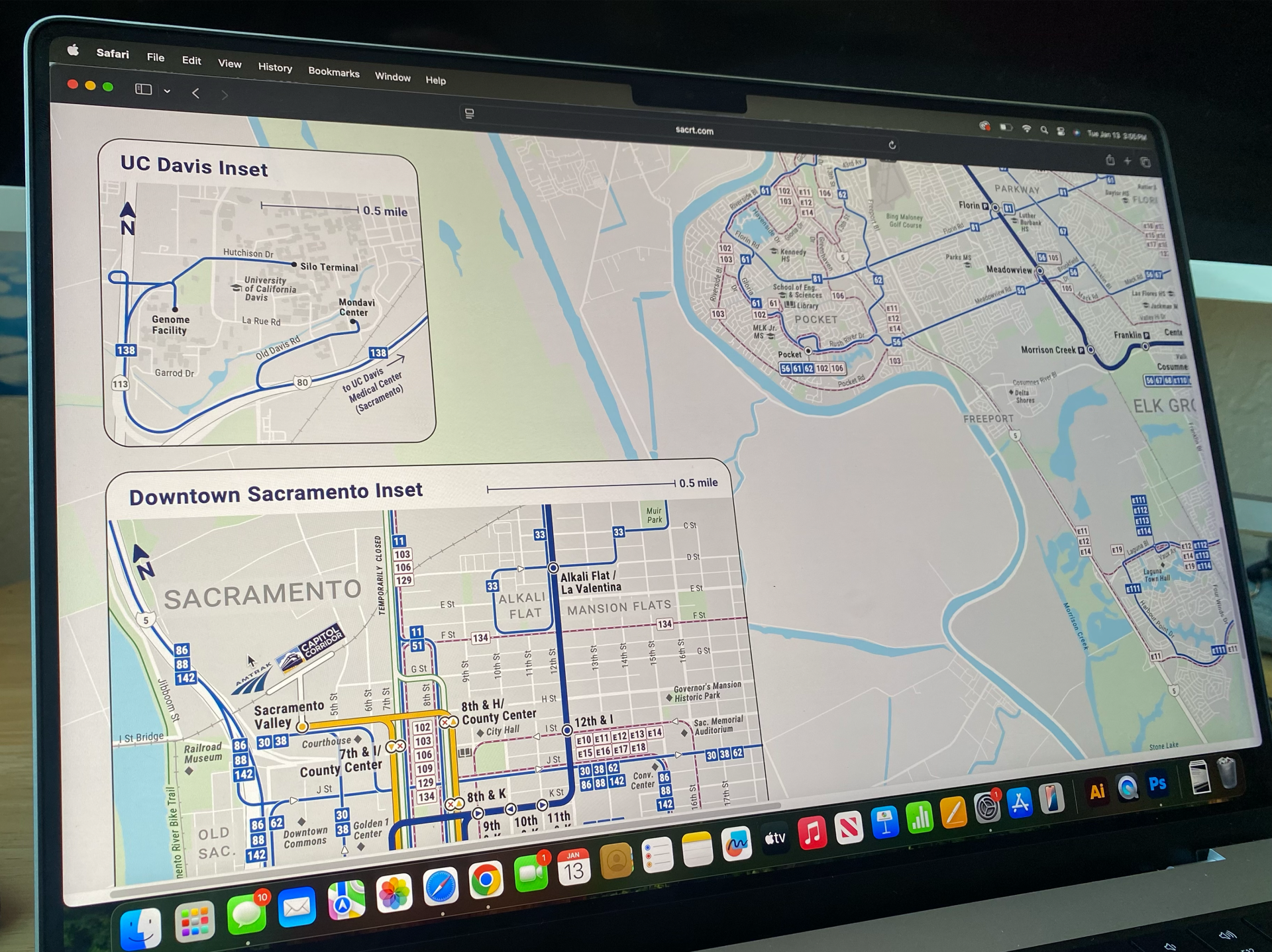
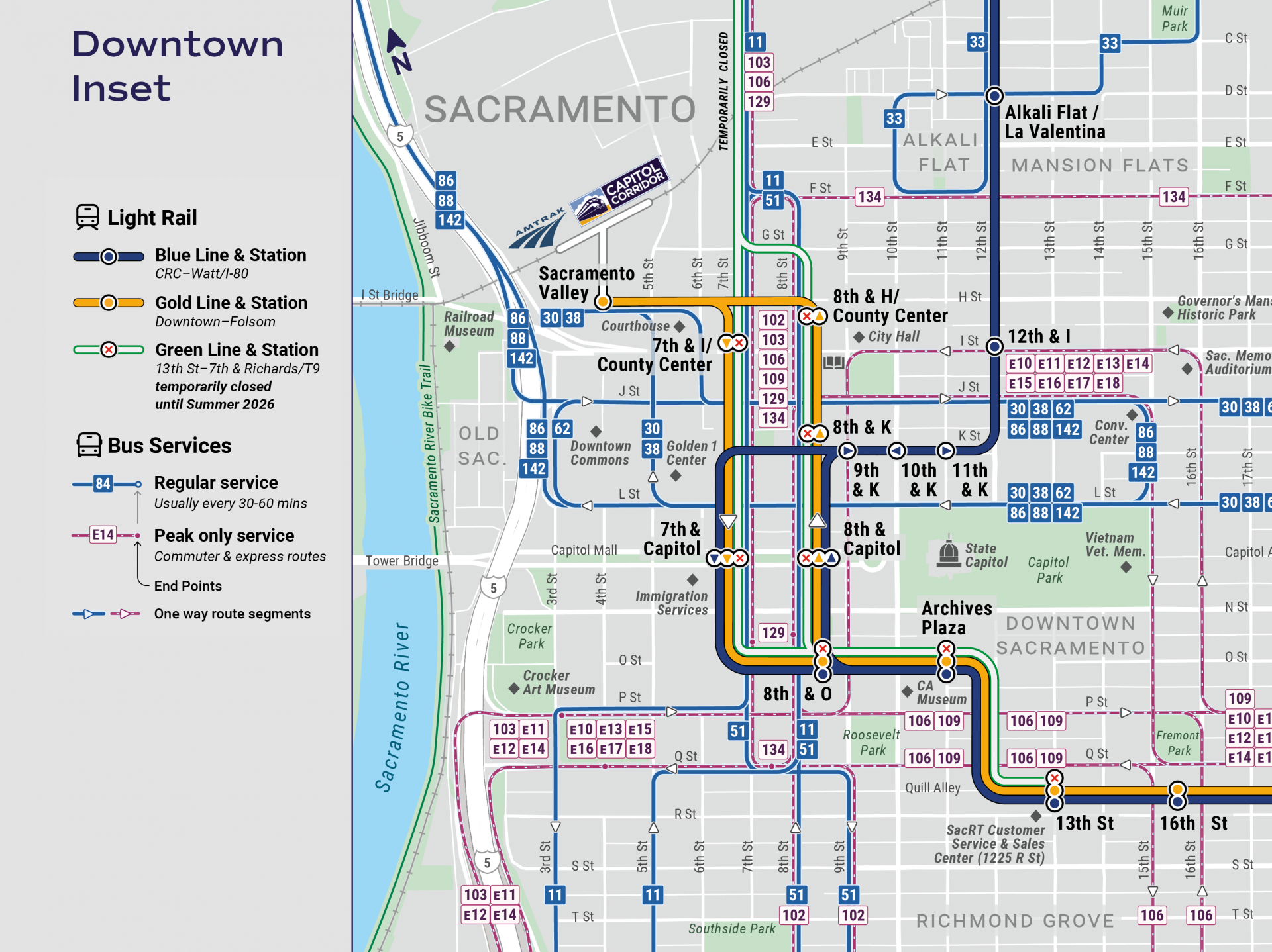
- Newly designed inset maps for areas needing additional clarity, including Downtown Sacramento and neighboring regional hubs
- High-resolution print files for 24×36-inch display cases, shelters, and light rail stations.
- Interactive layers enabling users to toggle routes and services for customized products.

Local area views